The Byway
The Mohawk Towpath National Scenic Byway is Unique in America. Explore the Intriguing Stories and History Found Along the Road.
The Mohawk Towpath Story
Traveling a busy highway to get to the Mohawk Towpath Scenic Byway, you wouldn’t envision such wonderful serenity awaits. Yet, as you turn at an intersection of trade and commerce in Upstate New York to move toward the route, it appears time has stopped. You’ll feel like you’ve dropped into another century. The land on which the Town of Halfmoon sits was purchased directly from the Mohawk Tribe in 1667. Strolling the streets of the Stockade District, you’ll pass buildings dating from 1670 and in Waterford, some constructed as early as 1770. The Old Military Crossing ford across the Mohawk River was guarded by Generals Enoch Poor and Benedict Arnold (America’s famous turncoat) during the Revolutionary War. The beautiful homes that overlook the Mohawk River in the Crescent-Church Hill Historic District have been reigning over the riverbanks for over 200 years.
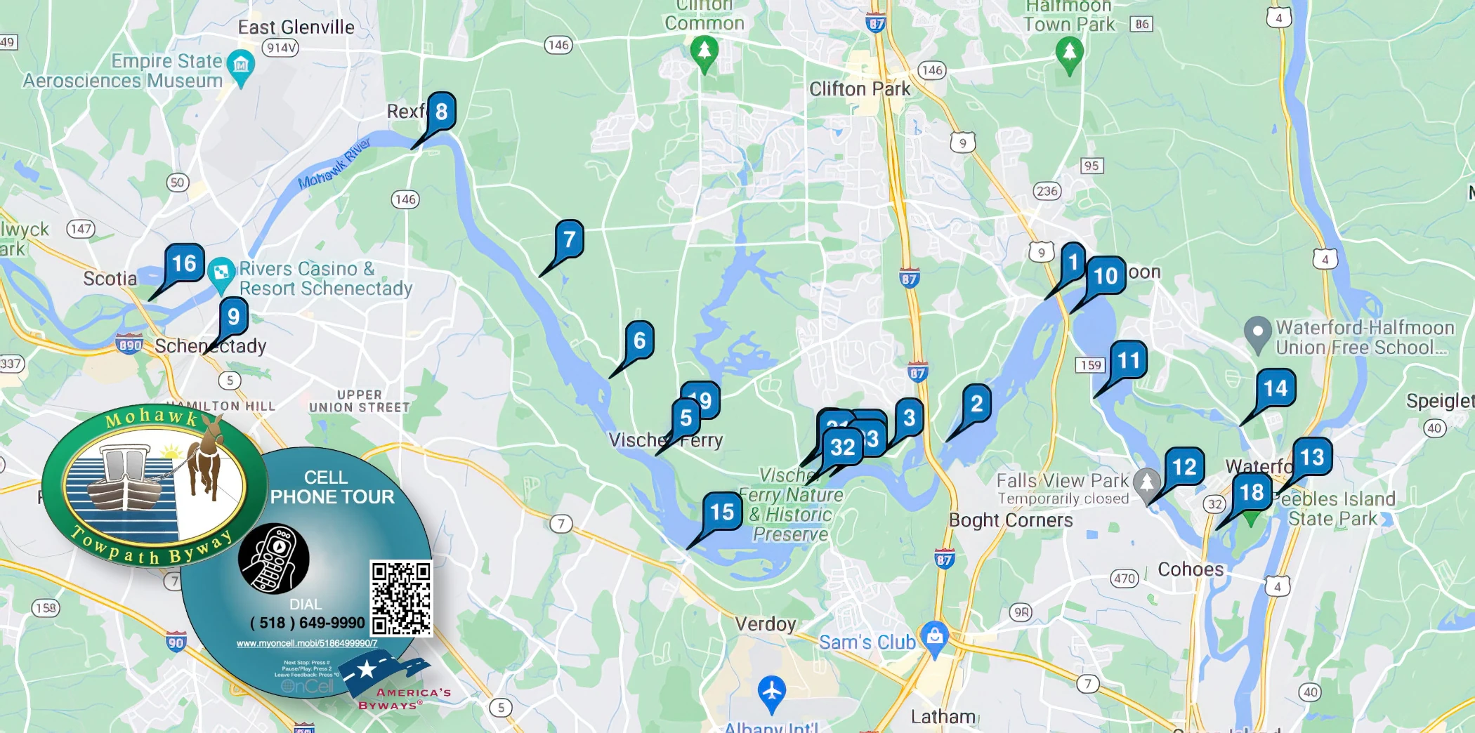
Exploring this beautiful, quiet, still rural corridor intertwined with natural areas and scenic beauty, the Mohawk Towpath Scenic Byway parallels the Mohawk River, the Erie Canal, and the New York Barge Canal from the Village of Waterford to the City of Schenectady. Along the route, where much of the landscape still looks like it did in 1825, you won’t know the busy Interstate nearby exists. Historic districts with buildings from canal days still stand proudly in towns along the way. Some thought the canal was a reckless idea. Instead, the water route through New York State became the central corridor through the Appalachians that sped up settlement of the United States further west and established New York City as a major seaport.
The name Mohawk Towpath Scenic Byway was chosen to commemorate the river and the towpath trod by the mules along the Erie Canal. After you experience the loop of the Byway that includes Cohoes, Waterford, and Halfmoon, slowly take the rest of the journey. Views of the river ebb and flow, all the while blessed with lush greenery. You’ll grow to truly appreciate the meandering route nestled within the trees. It’s peace and serenity at its finest and one of the best escapes from the bustle of life you’ll ever find.
Byway History
Stretching from the Hudson River to central New York State, the Mohawk River Valley was carved by glacial action during the Ice Age approximately 2 million years ago. Native American tribes resided in the Mohawk Valley for millenniums before Dutchman Henry Hudson plied the river named after him in 1609. The Dutch established a permanent settlement in the Stockade District (now in Schenectady) in 1660. Even with rapids that required portage, the Mohawk River became the main route between the eastern seaboard and the Great Lakes.
As early as 1783, plans were developed to build an alternative water route to expedite travel between the two. Continual efforts between 1810 and 1816 by New York State legislators to secure funding for constructing a canal between Albany and Buffalo were unsuccessful. When DeWitt Clinton became Governor of New York the following year, he boldly ordered work to begin in the city of Rome, in what became known as “Clinton’s Big Ditch.” After this inauspicious start, the original Erie Canal was carved across the state between 1817 and 1825.
The original canal channel was 40’ wide at the surface, 28’ feet wide at the bottom, and 4’ deep. More than 80 locks with pivoting gates allowed compartments to fill with water to raise the boats or open to lower the boats. The locks handled elevation changes totaling 689 feet along the route. Steep changes in elevation, such as the need to rise 180 feet at Cohoes, required several connected locks. In this case, 16 locks, called the terrible 16s, required an entire day for passage. Boats were towed on the water by mules walking along a path – or towpath – next to the canal. Besides spurring growth in New York City, the canal supported the communities of Waterford, Cohoes, Crescent, Vischer Ferry, Rexford, and Schenectady – historic places now located along the Byway.
Early train tracks were built parallel to the Mohawk River and the Canal from Albany to Schenectady in 1831, specifically to avoid the time delay of taking a boat through the 16 locks at Cohoes. After portions of the canal were expanded and rerouted in the 1840s, the remnant of the original Erie Canal served as a power canal for Harmony Mills. Yet, by the 1850s, railroads began competing with the Erie Canal for both passengers and freight. This prompted the enlargement of the canal to 70’ wide and 7’ deep in 1862, although the railroad ultimately eroded the cross-state waterway’s importance.
Still needing a waterway path through the region, the New York State Barge Canal, begun in 1903, encompassed 36 locks to lift vessels from Waterford at 15.2 feet to Lake Erie at 565.6 feet. Construction of the five large Flight of Locks at Waterford that replaced the original 16s raised the level 180 feet over the span of five miles. These improvements enabled the canal to continue as a significant transportation route for grain shipped from the Midwest to New York City for several more decades.

What To See & Do
The Mohawk Towpath Byway will Capture Your Attention for Days! Visit Key Attractions, Enjoy Outdoor Recreation, Do the Tours, and Attend Events.
Itineraries
Mohawk Towpath:
Journey to Another Place in Time Itinerary
Mohawk Towpath:
Return to Another Century Itinerary
For Your Drive
For Your Visit
Plan to Visitor for More Than A Day!
While Here Stay, Dine, Shop, Fuel Up and Let One of the Pre-Designed Itineraries Be Your Guide.
Support the Byway
If You’re a Visitor, You Can Contribute to the Non-Profit that Manages the Byway. If You’re a Business or Area Organization, You Can Join.
Great and easy path for walking, running or biking. Great views and clear paths.
Such a lovely Audubon space. Wish we had had more time!
Really cute and super accessible area. I went to take some pictures and there were a few people hiking as well…
Mohawk Towpath News
Corridor Management Plan
The Mohawk Towpath National Scenic Byway is reviewing and updating their corridor management plan (CMP). As a part of...
Winter Festivities
At Noon at the Clifton Park Common the Shenendehowa Rotary is holding their Fifth Annual Outhouse Race among some...
